The Short Answer: You Need a Car
Wyoming has no intercity bus network, no passenger rail service, and no rideshare infrastructure outside a handful of towns. Even in Jackson, the most walkable spot in the state, you need a vehicle to reach Grand Teton's trailheads, the National Elk Refuge, and Yellowstone's South Entrance. The distances between Wyoming's headliners are real: Jackson to Cody is about 2.5 to 3 hours in summer through Yellowstone; Jackson to Cheyenne is a solid 5.5 to 6 hours via US-191 south to I-80. Plan your itinerary around drive times the way you'd plan a city trip around subway stops.
Families and solo travelers alike end up at the rental counter, because the alternative is giving up half the state. If you're visiting from outside the US and aren't used to driving long distances, build extra time into every leg. Wyoming at 80 miles per hour on the interstates still takes longer than it looks on the map, and mountain roads run considerably slower.
Which Airport to Fly Into
Jackson Hole Airport (JAC) is the most practical landing point for the Tetons and southern Yellowstone. It sits inside Grand Teton National Park, nine miles north of Jackson town, and receives direct service from a dozen major US hubs. Rental cars are available on-site, but summer inventory disappears fast. Book your rental at JAC before you book your lodging. Expect to pay an estimated $100 to $160 per day in July and August, sometimes higher on holiday weekends.
Yellowstone Regional Airport in Cody (COD) is the right choice if Yellowstone's East Entrance is your primary focus, since the entrance is only 52 miles west on US-20. It's a smaller airport with Delta and United connections through Salt Lake City and Denver. Rentals are available but limited in fleet size, so book well ahead. Casper-Natrona County International (CPR) is the most central Wyoming option and a reasonable hub if your itinerary combines the Wind River country with the southeast corridor.
Many visitors skip Wyoming airports entirely and fly into Denver International (DEN) or Salt Lake City International (SLC). Denver is about 90 minutes south of Cheyenne on I-25, and roughly seven to eight hours from Jackson, which works well for a road trip that starts in the southeast and works northwest. Salt Lake City is about 4.5 hours from Jackson via US-89 north through Logan Canyon and into Idaho before picking up US-26 east. Bozeman Yellowstone International (BZN) in Montana is worth factoring in if your trip leans toward the north side of Yellowstone and the wildlife-heavy Lamar Valley, since Gardiner, Montana and the North Entrance are only about 90 minutes southeast of BZN.
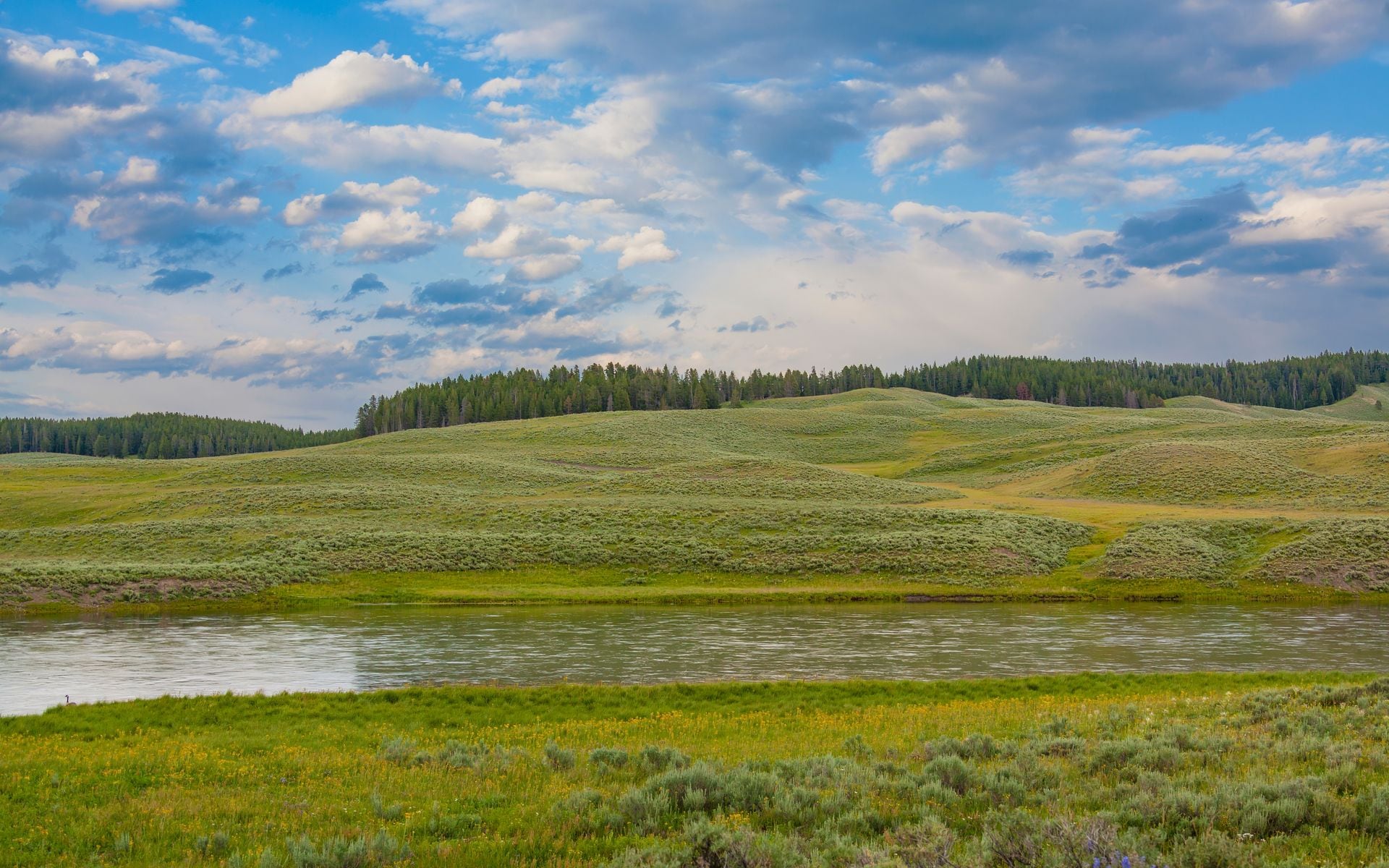
Key Distances and Drive Times
Here are the routes that matter most for planning. Jackson to the Grand Teton North Entrance at Moran Junction is about 25 miles and 30 to 35 minutes on US-26/89/191. Jackson to Yellowstone's South Entrance is roughly 57 miles and about an hour under normal summer conditions. Jackson to Cody through Yellowstone via the Grand Loop Road runs about 2.5 to 3 hours when the park roads are open, and the route through Hayden Valley and past the Grand Canyon of the Yellowstone makes the time worthwhile. If you're bypassing Yellowstone entirely, the drive from Jackson to Cody via US-26 east to Dubois, then US-287 north, then WY-120 north is closer to 3.5 hours.
Cody to Sheridan is about two hours heading north on US-14 through the Bighorn Basin. You can also take US-14A over the Bighorn Mountains, which is a slower and more dramatic route with a summit near 9,000 feet. Sheridan to Devils Tower is 85 miles east on I-90 and then US-14 south, about 1 hour 15 minutes. Thermopolis to Lander via US-20 and WY-789 is roughly 68 miles and just over an hour. That Thermopolis segment is worth knowing because Hot Springs State Park sits right there, and most Wind River Country loops pass through it on the way in or out.
Cheyenne to Laramie is only 50 miles west on I-80, about 45 minutes, which makes them a natural two-town pair for a southeast Wyoming base. Cheyenne to Denver International is 90 miles south on I-25, usually 1.5 hours barring traffic on the Colorado side of the border.
Seasonal Road Closures
Most of Yellowstone's interior roads close to cars in early November and reopen in phases from late April through mid-May. The Mammoth Hot Springs to Cooke City (Montana) corridor stays open year-round because Cooke City has no other winter road access. The road from the South Entrance to Old Faithful typically opens in early May; the West Thumb to Fishing Bridge segment usually opens in late April. These dates shift by a few days each year based on snowpack. Check the National Park Service road status page before you go rather than relying on typical dates.
The Teton Park Road, the inner scenic road through Grand Teton that parallels US-26/89/191, closes to vehicles from November through late April. One detail worth knowing: it opens to cyclists and pedestrians a few weeks before cars are allowed, making it a rare spring window for bike riding with the Teton peaks as a backdrop. The Beartooth Highway (US-212, between Red Lodge, Montana and Yellowstone's Northeast Entrance) closes in October or November and typically reopens in late May. Late June through September is the reliable window for that drive.
The Snowy Range Scenic Byway (WY-130) over Medicine Bow Pass between Laramie and Saratoga closes in winter, generally from late October into May. US-26 over Togwotee Pass between Dubois and Moran Junction stays open year-round, but winter driving requires chains or a capable 4WD vehicle. If you're traveling outside of June through early October, verify every mountain road before committing to a route. Wyoming 511 (dial 511 or visit wyoroad.info) provides real-time road status and is the most reliable source during shoulder seasons.
Practical Tips for the Road
Gas up whenever you see a station. Between Dubois and Moran Junction on US-26/89/287, there is roughly a 55-mile stretch with no fuel services. Similar gaps exist in the Bighorn Basin and on the back roads of the Wind River Country. A quarter tank should not make you comfortable in Wyoming. Keep a full-tank habit, especially if you're driving anything with poor fuel economy.
Wyoming interstates run at 80 mph on I-80 and I-25, among the highest limits in the country. The miles go quickly, but don't let that lull you in spring and fall weather. The stretch of I-80 between Rawlins and Laramie is one of the windiest corridors in the Lower 48 and can close entirely in serious blizzards, stranding travelers for hours with no exit. In winter or shoulder seasons, treat every high-plains and mountain drive as something to research the night before.
Cell coverage drops off fast outside towns. Download offline maps before leaving your motel, and carry a printed Wyoming state road map as backup. They're free at visitor centers and welcome stations near state borders. AWD or 4WD is worth paying the upgrade for if you're traveling in May, October, or November, or if you plan any unpaved forest roads. Many trailhead access roads in the Wind River Range and the Bighorns require high-clearance vehicles even in summer.
Book your rental car before you book flights, hotels, or anything else. Jackson Hole Airport is a small terminal with limited fleet capacity, and summer inventory runs short by March or April. If JAC rates seem unreasonable, check pricing on a pickup at Salt Lake City and drive the 4.5 hours north. Once you know where you're based, our where to stay guide breaks down lodging by region so you can find the base that cuts daily driving to a minimum. For packing, chains or traction devices in winter and a physical road atlas round out the essentials most people forget. The full Wyoming Travel Guide covers everything from park reservations to the best rodeos, so you can plan the rest of the trip while the car rental is locked in.
Frequently asked questions
Do I need to rent a car to visit Wyoming?
Yes, in almost every case. There is no intercity bus or passenger train service in Wyoming, and rideshares are unreliable outside a few towns. Even if you're staying in Jackson and only visiting Grand Teton National Park, you need a vehicle to reach trailheads, the National Elk Refuge, and Yellowstone's South Entrance. Book a rental car before you book anything else.
Can I visit Yellowstone without renting a car?
A handful of tour operators run summer day-trip shuttles between Jackson and Yellowstone, and that works if you only want a single guided day in the park. But for independent travel, including multiple stops, wildlife watching in the Lamar Valley, or overnights inside Yellowstone, you need your own vehicle. The shuttle option also puts you on someone else's schedule for the whole day and limits where you can stop.
How long does it take to drive across Wyoming?
East to west on I-80 from Cheyenne to the Utah border near Evanston is about 400 miles and 4.5 to 5 hours. North to south on I-25 from Sheridan to Cheyenne is about 200 miles and 2.5 hours. The long diagonal from Jackson in the northwest to Cheyenne in the southeast runs close to six hours nonstop on a summer day. Wyoming looks manageable on a map, but the scale surprises most first-time visitors.
Is Uber or Lyft available in Wyoming?
Both apps exist in larger Wyoming towns, including Jackson, Cheyenne, and Casper, but driver availability is thin and waits can be long, especially outside normal business hours or peak tourist season. In Cody, Sheridan, Lander, Thermopolis, or Pinedale, you should not count on app-based rideshares as a reliable transportation option. A rental car is the right tool for the state.
What kind of vehicle do I need for Wyoming?
A standard passenger car handles most Wyoming routes in summer. AWD or 4WD becomes worthwhile in spring, fall, and winter, particularly if you're driving over Togwotee Pass, into the Bighorns on US-14A, or accessing any unpaved forest roads. High-clearance vehicles are needed for many Wind River Range trailhead access roads. If your trip includes any backcountry driving or shoulder-season mountain routes, ask specifically about AWD when booking your rental.