Overview
Wyoming gives hikers more trail options per square mile than almost any other state, and most of those options come without the crowds you find in Colorado or Utah on summer weekends. Two national parks, three national forests, the Wind River Range, the Bighorn Mountains, Vedauwoo near Laramie, and stretches of Bureau of Land Management land across the Red Desert add up to a trail system that could fill years of weekends. The Wyoming Travel Guide covers how the state's regions connect before you start planning, which matters here because trailheads can be 200 miles apart.
Northwest Wyoming, anchored by Grand Teton and Yellowstone, holds the most-visited trails in the state. Cascade Canyon out of Jenny Lake is a 14-mile round-trip that earns its reputation: the trail climbs into a glacially carved canyon below the Cathedral Group peaks, with views of the Grand Teton, Mount Owen, and Teewinot that stay with you. Hidden Falls and Inspiration Point is a shorter option at 4.6 miles round-trip, and one of the most-walked trails in the Tetons for good reason. Yellowstone adds a different texture, where the Fairy Falls trail (5.4 miles round-trip from the Fountain Flat Drive trailhead off Firehole Lake Drive) passes the tallest geyser in the park and ends in an active thermal basin. Most of the Teton valley trails open by late May; the high-country routes in both parks can hold snow into June in a typical winter.
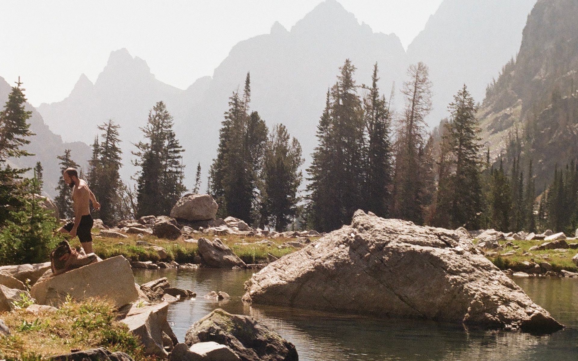
For hikers who want fewer people and more serious terrain, central Wyoming is the answer. The Wind River Range, reached from Lander, Pinedale, or Dubois, is Wyoming's most remote mountain wilderness: more than 40 peaks above 13,000 feet, Gannett Peak at 13,809 feet (the state high point), and the Cirque of the Towers. Sinks Canyon State Park, seven miles south of Lander on US-131, is one of the best free day-hike areas in the state. The Popo Agie River disappears into a limestone cavern at the Sinks and re-emerges 400 yards downstream at the Rise, with short connecting trails and longer canyon hikes into the Wind River foothills above. In southeastern Wyoming, Curt Gowdy State Park about 25 miles west of Cheyenne on Happy Jack Road has more than 35 miles of marked trails through Medicine Bow foothills terrain, from easy reservoir-loop walks to steeper ridge routes, and it works well as a warm-up day for visitors arriving from Denver before driving to the parks.
What to Expect
Altitude is the first thing to understand. Wind River Range trailheads typically start above 9,000 feet, and the popular Elkhart Park trailhead north of Pinedale sits at 9,400 feet before climbing to passes above 11,000. Even in Grand Teton and Jackson Hole, the valley floor sits at 6,800 feet. Visitors flying in from sea level regularly underestimate how much harder moderate climbs feel up here, and Wyoming's dry, low-humidity air accelerates dehydration. Plan to spend at least one day at intermediate elevation before any big push, drink more water than you think you need, and cut your planned mileage back from what you would do at home until you know how your body responds.
Wildlife encounters are not optional in Wyoming's backcountry; they are built into the experience. Grizzly bears live across northwest Wyoming, including Grand Teton National Park and most of the Wind River Range. Carry bear spray clipped where you can access it in under two seconds, not in your pack lid, and hike in groups of three or more in grizzly country. Make noise on blind corners. Black bears are common statewide. Moose, bison, and elk are not predators but they are large and can charge if they feel pressured: stay at least 75 yards from all of them, and back away calmly if any animal changes its behavior toward you. Afternoon thunderstorms build fast over Wyoming's mountain ranges between late June and mid-August. Starting high-elevation hikes before 8 a.m. and being off exposed ridgelines by noon is a real rule, not a suggestion.
Wind River Range backpacking requires no permit on most routes, which is unusual for wilderness of this quality and one of the main reasons experienced backpackers choose it over more-regulated destinations. The most common entry points are the Big Sandy trailhead at the end of Big Sandy Road south of Pinedale and the Elkhart Park trailhead north of Pinedale. Both lead toward the Cirque of the Towers, the most iconic objective in the range, and parking at these trailheads fills before 7 a.m. on summer weekends in July and August. Arrive the evening before if you want a spot. Yellowstone and Grand Teton require backcountry camping permits; details are in the How to Book section below.
Best Season
The main hiking window runs late June through early October, with high-country access tightening on both ends. Jenny Lake trails and the Valley Trail along the base of the Tetons are usually clear by early June. Wind River high passes typically clear of snow by late June or early July; after a heavy winter it can push to mid-July. The Teton Park Road opens to vehicles in mid-May, giving early access to the String Lake and Leigh Lake trailheads, both of which stay lower in elevation and tend to be snow-free by late May. Yellowstone's interior roads open to cars in late April or early May, but backcountry routes above 9,000 feet in the park stay snowed in well into June.
September and early October are, for many Wyoming hikers, the best weeks to be out. Trails that were crowded in July are noticeably quieter after Labor Day. Daytime highs in the 50s and 60s Fahrenheit at elevation make for comfortable pace without the afternoon thunderstorm risk that defines July and August. The aspen groves across the Tetons and the Bighorns turn gold in late September, and the elk rut (typically peaking the third and fourth weeks of September) adds something memorable to early morning walks in the valleys. High-country snow can arrive by late September; carry layers even on clear days, and check forecasts before heading above tree line.
Typical Costs (Estimates)
Day hiking in Wyoming's national parks requires a park entrance fee. Estimate $35 per vehicle for a seven-day pass to Yellowstone or Grand Teton, or $80 for the America the Beautiful annual pass, which covers both parks and every other federal fee site in the country for a full year. That pass pays for itself fast if you are spending more than two or three days in the parks. State parks like Sinks Canyon and Curt Gowdy charge a day-use fee of roughly $4 to $7 per person for Wyoming non-residents. National Forest and BLM land is free to hike with no registration needed on most trailheads.
Guided hiking in the Jackson Hole area runs approximately $100 to $200 per person for a half-day excursion and $175 to $350 per person for a full-day guided hike, with rates that vary by group size and how remote the destination is. Jackson Hole EcoTour Adventures, based in Jackson, runs guided naturalist hikes including winter snowshoe trips inside Grand Teton National Park, with rates that shift by season and trip length. Multi-day guided backpacking trips in the Wind River Range, where outfitters carry gear on stock animals, typically run $250 to $450 per person per day all-in. Yellowstone backcountry camping permits cost $3 per person per night; Grand Teton backcountry permits are free but require registration through the park system.
How to Book
For Yellowstone backcountry camping, reserve permits through recreation.gov starting April 1 each year. Walk-up permits are available at Yellowstone visitor centers up to 48 hours before the first night of your trip, but popular campsites in the Lamar Valley, the Shoshone Lake area, and the Heart Lake backcountry fill fast in July and August. Grand Teton backcountry permits are free; the advance reservation system opens each January for peak-season dates, and walk-up permits are available at the Jenny Lake Ranger Station starting at 8 a.m. the day before your first night out. Wind River Range trailheads on Bridger Wilderness land are permit-free on most routes, though the Cirque of the Towers and Big Sandy Lake area can fill trailhead parking before 7 a.m. on summer weekends.
For guided hiking and naturalist-led day hikes, the Tour Operators and Guides directory lists outfitters sorted by region. If you are stacking a hiking trip with a broader Wyoming road trip, the Yellowstone and Grand Teton Road Trip itinerary maps out how to combine hiking days across both parks without unnecessary backtracking. Some Wyoming dude ranches include guided trail hiking as part of their packages, particularly in the Jackson Hole valley and the Bighorn foothills around Sheridan. Wyoming's outdoor calendar extends well beyond the summer hiking season: snowmobiling opens different parts of the state from December through March, and rodeos and cowboy culture run through summer in every region if you want a different kind of Wyoming day.
Frequently asked questions
Do you need permits to hike in Yellowstone and Grand Teton?
Day hiking in both parks requires only the park entrance fee, no separate hiking permit. Backcountry overnight camping is different. Yellowstone charges $3 per person per night for backcountry camping permits, which you can reserve at recreation.gov starting April 1 or pick up as walk-up permits at visitor centers up to 48 hours before your trip. Grand Teton backcountry camping is free but requires a permit, available through the park's online reservation system (which opens each January for peak dates) or as a walk-up at the Jenny Lake Ranger Station starting the morning before your first night out.
What should I know about hiking in bear country in Wyoming?
Grizzly bears are present throughout northwest Wyoming, including Grand Teton National Park, Yellowstone, and most of the Wind River Range. Carry bear spray clipped on your hip where you can access it in two seconds or less. Hike in groups of three or more when possible, make noise on blind corners, and store all food and scented items in a bear canister or hang them at camp on a proper bear hang at least 10 feet up and 4 feet from the trunk. Black bears live statewide. Moose are common and can be aggressive, especially cows with calves in spring and early summer: give them at least 75 yards of space and back away slowly if they show any stress.
What are the best short hikes near Jackson that don't require driving far into the parks?
Cache Creek Canyon, about a mile from Jackson's town square, has a flat trail along Cache Creek that works well for families and is free to access year-round. Snow King Mountain above town has trails that gain 1,500 feet from the base area and offer good views of the valley. The String Lake trailhead in Grand Teton is about 20 minutes north of Jackson via US-191 and the Teton Park Road, and the flat 3.5-mile loop around String Lake is one of the most accessible hikes in the park with Teton views the entire way. The Leigh Lake extension adds another two miles for hikers who want more. Both are usually clear by late May or early June.