Why Visit Sheridan & the Bighorns
The Bighorn Mountains rise to 13,175 feet at Cloud Peak and run roughly 100 miles north to south through Bighorn National Forest. Three scenic byways bisect the range, and the 189,000-acre Cloud Peak Wilderness inside the forest holds roadless backcountry that most out-of-state visitors have never heard of. From the alpine lakes near the wilderness boundary down to the high-desert foothills where the ranches run, this region packs a full Wyoming experience without the congestion of the parks.
What this region does especially well is the intersection of ranch culture and public land. The Brinton Museum in the small community of Big Horn, about 12 miles south of Sheridan, sits on the original Quarter Circle A Ranch and houses a serious collection of Western and Native American art in a setting that still reads as a working ranch rather than a gallery. The WYO Rodeo runs four nights each mid-July at the Sheridan County Fairgrounds, a legitimate PRCA event with top cowboys competing in bareback riding, saddle bronc, bull riding, and barrel racing. Tickets run an estimated $15 to $30. And Medicine Wheel, a 75-foot-diameter stone circle on Medicine Mountain at 9,642 feet above sea level, is one of the most significant sacred and archaeological sites in Wyoming, accessible by a 1.5-mile dirt access road from US-14A roughly from mid-June through mid-October.
The Wyoming Travel Guide covers the whole state, but this corner in particular rewards anyone who wants real ranch-country Wyoming and is willing to drive the Bighorn passes to find it.
Top Places in Sheridan & the Bighorns
Sheridan is the largest town in the region, around 18,000 people, and sits at the foot of the Bighorns along I-90. Main Street is one of the more intact historic commercial strips in Wyoming: the Sheridan Inn anchors the north end, built in 1893 for the Burlington and Missouri Railroad. Buffalo Bill Cody used its front porch to audition performers for his Wild West show. The inn still operates a bar and restaurant. King's Saddlery on Main Street is a working saddle shop that doubles as one of the best Western-goods stores in the state, well worth a stop on its own.
Buffalo, about 35 miles south of Sheridan on I-90, is a quieter ranch town near the Powder River. The Jim Gatchell Memorial Museum on Fort Street covers Johnson County history, including the range wars of the 1890s, and is worth an hour. Buffalo is also the eastern trailhead gateway to the Cloud Peak Wilderness via US-16 west through Ten Sleep Canyon.
Devils Tower sits in the northeast corner of Wyoming near the towns of Hulett and Sundance, about 90 minutes east of Sheridan on I-90 to Sundance and north on US-24. The 867-foot volcanic column was declared the country's first national monument by President Theodore Roosevelt in 1906. The paved 1.3-mile Tower Trail loops its base and gives you close views of the columnar basalt formations. The tower is a sacred site to many Northern Plains tribes, and a dozen crack-climbing routes attract experienced climbers from May through October. The entrance fee is covered by the America the Beautiful annual pass (estimated $80).
Bighorn Canyon National Recreation Area sits about 70 miles northwest of Sheridan via US-14A through Lovell, Wyoming. The canyon runs 55 miles along the Wyoming and Montana border, and much of it is accessible only by boat on Bighorn Lake behind Yellowtail Dam. The canyon walls rise up to 1,000 feet and fishing runs to trout, walleye, and bass. The Pryor Mountains on the Montana side shelter one of the few remaining wild horse herds in the region.
Top Things to Do
Driving the Bighorn Scenic Byways is the single most efficient way to take in the range. US-14 climbs from Dayton (on the eastern slope, about 20 miles north of Sheridan) over Burgess Junction and down to Greybull through Bighorn National Forest, passing spruce-fir forest and wide alpine views. US-14A takes the northern route from Lovell up over Medicine Mountain to Burgess Junction, with the Medicine Wheel National Historic Landmark accessible via a left turn at the summit. Both routes are typically open from late May through October. The 14A summit section can close with early-season or late-season snow. A half-day is enough to drive one pass with stops; a full day gets you over both.
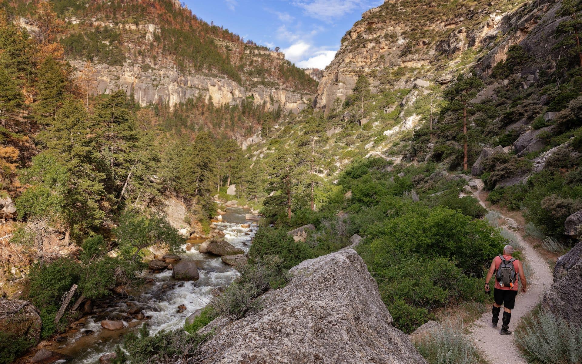
Hiking and backpacking in Cloud Peak Wilderness requires no permit and draws far fewer people than similar terrain in the Wind River Range or the parks. The Hunter Corrals trailhead east of Buffalo on the eastern slope provides access to Shelf Lake, about 7 miles in, and the higher lake basins beyond. The Tensleep approach via Sitting Bull Campground on the western slope suits people approaching from Worland and Ten Sleep Canyon on US-16. Cloud Peak at 13,175 feet is a technical summit in summer conditions, but the high lake basins are reachable for fit hikers without technical gear. July through mid-September is the reliable window; afternoon lightning storms build over the mountains most summer days.
Fishing the Tongue River is an underrated option in this region. The Tongue runs east out of the Bighorns through Dayton and Ranchester and holds brown and rainbow trout accessible from public land along the river corridor. Best fishing runs late June through early September before fall flows drop. For gear, licenses, and local intel on current conditions, Sportsman's Warehouse on E. 5th Street in Sheridan is the practical first stop.
The WYO Rodeo in mid-July is the kind of event that distinguishes this region from the more tourist-heavy corners of Wyoming. Four nights at the Sheridan County Fairgrounds, top PRCA competitors, and a crowd that skews toward Wyoming locals rather than out-of-staters make it worth timing your visit around. If you want the full ranch-culture experience beyond the rodeo, the Best Dude Ranches in Wyoming page covers operations in the Bighorn foothills south of Sheridan, where several multi-generation ranches take guests on week-long or multi-night stays.
Where to Stay
Sheridan is the most practical base for the region. Hotels cluster along I-90 and on 5th Street, with summer rates running an estimated $90 to $160 per night at chain and independent properties. Wyoming's Rib & Chop House on N. Main Street in Sheridan is the reliable choice for dinner after a day in the mountains, with prime rib and beef-forward mains in a straightforward dining room. For orientation on local events and current ranch and lodging options in the area, Sheridan County Travel & Tourism on W. 5th Street is the place to start.
Gillette, about 65 miles east of Sheridan on I-90, is the most convenient overnight for travelers spending time near Devils Tower. The La Quinta Inn & Suites by Wyndham Gillette offers consistent lodging at an estimated $120 to $175 per night in summer, close to the interstate.
Dude ranches south of Sheridan and in the Bighorn foothills range from four-night to full-week all-inclusive stays, priced at an estimated $300 to $600 per person per day with meals, horses, and activities included. For a broader look at where to base yourself across the state, the Where to Stay in Wyoming guide breaks down the tradeoffs by region and season.
Getting There and Around
The most practical fly-in airport for Sheridan is Billings Logan International (BIL) in Montana, about 70 miles north on I-90, with direct service from Denver, Salt Lake City, Seattle, and other western hubs. Sheridan Airport (SHR) has limited commuter service, mainly to Denver via small regional aircraft. Gillette Campbell County Airport (GCC) is about 65 miles east and has somewhat more frequency than Sheridan. Most travelers doing a multi-region Wyoming trip fly into Jackson Hole (JAC) or Casper (CPR) and drive north; Casper to Sheridan is about 2 hours on I-25 and I-90.
A rental car is the only realistic way to explore this region. Sheridan to Buffalo is 35 miles south on I-90. Sheridan to Devils Tower is about 90 minutes east on I-90 and US-24. The Bighorn scenic byways require a car, and the Cloud Peak Wilderness trailheads sit 20 to 40 miles from the nearest towns, partly on unpaved forest roads. Cell service is thin on both US-14 routes over the Bighorns, so download offline maps before you leave Sheridan. Denver is about 5.5 hours south on I-25.
Best Time to Visit
Summer, from late June through August, is when the Bighorn passes are fully open, the WYO Rodeo runs in July, and the Cloud Peak Wilderness trails are clear of snow. Sheridan July days average around 85 to 90 degrees Fahrenheit, with afternoon thunderstorms common over the mountains. Nights cool into the mid-50s. Medicine Wheel is accessible from roughly mid-June. This is also the busiest period; book hotels in Sheridan a few weeks ahead for WYO Rodeo week.
Fall is the best-kept secret in this region. September brings the elk rut to the Bighorn foothills, with bulls bugling by the second week of the month along the drainages east of the mountains. Golden aspen runs through the Bighorns from roughly late September into early October. US-14 and US-14A can close after early October snowfalls, so a September visit gives you full pass access and much smaller crowds than summer.
Winter in Sheridan runs cold with an average of around 60 inches of seasonal snowfall; the Bighorns receive considerably more. The Bighorn passes close for the season, typically by late October, and don't reopen until late May. Spring is mud season. The scenic byways through the Bighorns are worth checking on Wyoming 511 (wyoroad.info) before attempting in May or early June.
Frequently asked questions
How far is Sheridan, Wyoming from Yellowstone National Park?
Sheridan sits on the northeast edge of Wyoming and is not a practical base for Yellowstone day trips. The most common route goes south on I-90 to Buffalo, west on US-16 through Ten Sleep Canyon to Worland, then north on US-20 to Cody and west on US-14/16/20 to the East Entrance, roughly 4 to 4.5 hours. An alternate goes southwest over the Bighorns via US-14 through Greybull, adding scenic driving but not saving much time. If Yellowstone is your primary destination, Cody or Jackson is a more efficient base.
Is Devils Tower worth a detour from Sheridan?
Yes. Devils Tower is about 90 minutes east of Sheridan on I-90 to Sundance, then north on US-24. The 1.3-mile paved Tower Trail loops the base and takes about 45 minutes at an easy pace. Sunrise and early morning offer the best light. If you're a climber, Durrance (5.7) is the most-traveled route and the tower sees steady traffic May through October, though some routes close in June for nesting prairie falcons. Add a stop in Hulett for lunch and you have a comfortable half-day outing from Sheridan.
What is the best hiking in the Bighorn Mountains?
The Hunter Corrals trailhead, accessed from US-16 east of Buffalo, is the main eastern gateway into the Cloud Peak Wilderness and one of the most rewarding approaches in the Bighorns. The route to Shelf Lake is about 14 miles roundtrip with significant elevation gain. For a shorter outing, the Seven Brothers Lakes area is accessible from Tyrell Campground via about a 4-mile round trip. No wilderness permit is required in Bighorn National Forest, but Leave No Trace rules apply and camping near water requires a 200-foot setback. The realistic hiking window is early July through mid-September.
Are there dude ranches near Sheridan?
Several ranches operate south of Sheridan in the foothills between the Bighorns and the Powder River Basin, most offering multi-night packages with horseback riding, cattle work, guided fishing, and ranch-cooked meals. Rates typically run an estimated $300 to $600 per person per day all-inclusive, with minimum stays of three to seven nights depending on the operation. See the Best Dude Ranches in Wyoming page for a full breakdown, and contact Sheridan County Travel & Tourism in Sheridan for current operating properties and availability.