How We Picked These Towns
The Wyoming travel guide focuses on places with something specific to offer: a working downtown you can explore on foot, genuine outdoor access from the town itself, and lodging that fits the landscape rather than fighting it. Population was not the only filter, but every town on this list sits well under 35,000 people and functions as a real community rather than a strip of chain hotels. Wyoming is a wide state, and knowing the actual drive times between these towns matters when you are planning days. The nine picks below cover the state from the Bighorn Basin to Carbon County, and each one earns its place for a different reason.
Cody
Cody sits 52 miles east of Yellowstone's East Entrance along US-20 through the Wapiti Valley, and it is the strongest base on that side of the park. The Buffalo Bill Center of the West on Sheridan Avenue is a five-museum complex covering Western art, Plains Indian culture, natural history, and firearms, and a full day there is not an overcommitment. The Cody Nite Rodeo runs every night from June 1 through August 31 with PRCA-caliber roughstock and roping events; tickets run roughly $25 to $30 per adult (estimated 2026). The Chief Joseph Scenic Byway northwest of town, climbing toward Dead Indian Pass before linking to the Beartooth Highway, is one of the more dramatic routes in the region and worth building a day around.
For lodging with genuine character, Buffalo Bill's Irma Hotel and Restaurant on Sheridan Avenue was built in 1902 and named for Buffalo Bill's youngest daughter. The cherrywood back bar in the dining room was reputedly a gift from Queen Victoria to Buffalo Bill himself. The building operates as a hotel with rooms in both the original structure and a newer wing, and the dining room stays busy through summer. If you want something with dinner-show energy, The Cody Cattle Company on Demaris Drive runs a chuck wagon buffet with live Western music most summer evenings. For a wider look at lodging across the region, the Hotels and Lodges directory has options at multiple price points.
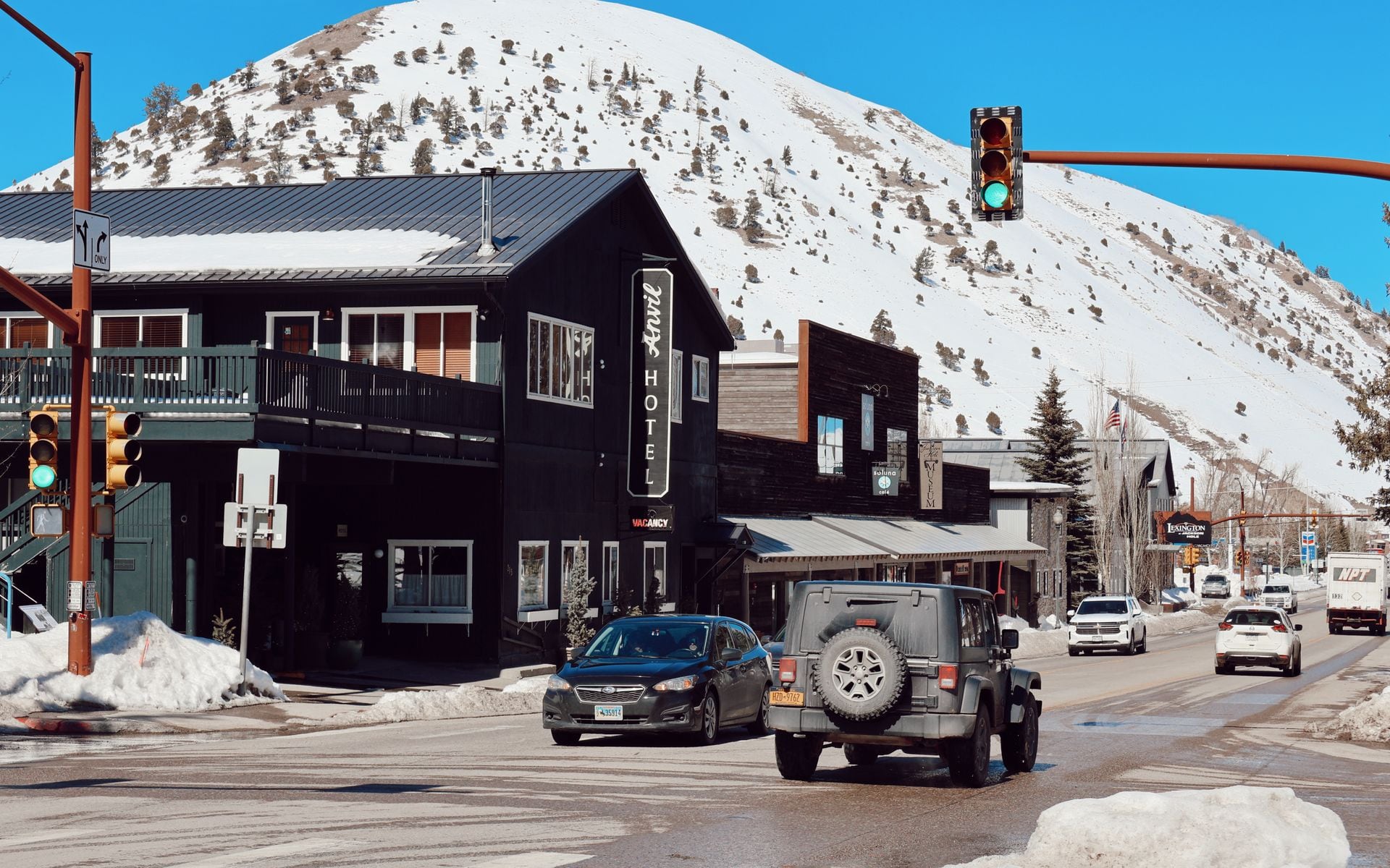
Sheridan
Sheridan is at the foot of the Bighorn Mountains where I-90 bends toward South Dakota, about 45 minutes north of Buffalo. Main Street has bookstores, outfitters, a proper steakhouse, and a hardware store that has been selling saddle blankets since the 1890s, which tells you something about the town. The Sheridan Inn, opened in 1893 and once managed by Buffalo Bill during the peak of his Wild West show career, anchors the north end of Main Street with a wide wraparound porch and steady lunch trade. The WYO Rodeo runs in mid-July with PRCA-sanctioned events, a street dance on Main Street, and a parade that shuts down traffic for a morning.
The Bighorn Scenic Byway on US-14 leaves Sheridan heading west and climbs 60 miles over 9,666-foot Granite Pass through Bighorn National Forest to Tensleep Canyon and the Shell Falls overlook, with serious switchback grades and good canyon views on the lower stretch. Cloud Peak Wilderness, where the Bighorn Range tops 13,000 feet at Cloud Peak itself, begins about 25 miles from downtown via Forest Road 26. Sheridan is also about 70 miles southwest of Devils Tower via US-14 and WY-24, a solid half-day loop from town.
Lander
Lander is a climbing and backpacking town in the Wind River foothills, about 80 miles south of Dubois on US-287 and 160 miles east of Jackson. Sinks Canyon State Park begins 8 miles southwest of downtown via WY-131, where the Middle Fork of the Popo Agie River disappears into a limestone cave and reappears from a different opening 900 feet downstream, a geological quirk that makes this worth a stop even if you skip the trail. The hike to Popo Agie Falls from the state park trailhead is 3.3 miles round trip and gains about 600 feet.
Lander has a real outdoor-focused downtown with gear shops, coffee roasters, and a modest brewery scene. The climbing community discovered the sandstone crags in Sinks Canyon in the 1990s, and the town has leaned into that identity rather than pivoting to a resort model. July and August are the best months for hiking in the high Wind River country; the upper trailheads can carry snow into June. For more serious backcountry access toward the Cirque of the Towers, Big Sandy Lodge Road out of Pinedale is the southern approach, but Lander-based guides run expeditions in from the eastern trailheads as well.
Thermopolis
Thermopolis is a Big Horn Basin town on the Bighorn River, about 85 miles north of Riverton on US-20 and 90 miles south of Cody. Hot Springs State Park, free to enter, contains one of the largest mineral hot springs in the world and the State Bath House where soaking is free seven days a week. The travertine terraces along the river and a bison herd that grazes on the park grounds give the place more to do than a single soak. The hot springs run year-round, but fall and early winter, when the air temperature drops and the steam off the pools thickens, offer the most atmospheric soaking.
The Wyoming Dinosaur Center on the north side of town maintains active fossil dig sites and runs guided tours of bones in situ, a different experience from the standard museum walk-through. Dig site tours run roughly $15 to $20 per adult (estimated 2026). Thermopolis sits midway between Cody and the Wind River Country towns, making it a solid half-day stop on a north-south route. For more soaking spots across Wyoming, Best Hot Springs in Wyoming covers additional sites from Saratoga to Star Valley.
Dubois
Dubois sits on the Wind River at 6,917 feet elevation along US-26/287, about 55 miles east of Jackson over 9,658-foot Togwotee Pass. The pass is closed to vehicle traffic in winter and typically opens in May depending on snowpack, which means Dubois is functionally cut off from Jackson for four to five months. If you are coming from the east, the Wind River Canyon Scenic Byway through the Owl Creek Mountains runs about 90 miles south via Thermopolis on US-20 and gives you a canyon drive that stands on its own as a reason to take that route.
Dubois holds one of the largest Rocky Mountain bighorn sheep populations in North America, and Whiskey Basin just west of town is a primary winter range for several hundred animals. The Dubois Badlands, a stretch of eroded red and orange clay buttes north of the highway, are worth a slow drive in late afternoon light when the color is strongest. Dubois functions as a natural connection point between the Jackson Hole and Tetons region to the west and Wind River Country to the east, with quieter lodging and lower prices than anything on the Jackson side of the pass.
Pinedale
Pinedale sits at 7,175 feet on the west slope of the Wind River Range, about 80 miles southeast of Jackson on US-191. The town is the most practical base for the Green River Lakes, where the upper Green River cuts through a glacially carved valley with Squaretop Mountain visible from the trailhead parking lot. The drive to Green River Lakes Campground from Pinedale is about 50 miles on a maintained gravel road, and the area is reliably open July through September. Day hikers do the 4-mile round trip to Lower Green River Lake; backpackers continue north into the Bridger Wilderness for multi-night loops with minimal crowds.
The Bridger Wilderness also holds the western approach to Gannett Peak, Wyoming's highest point at 13,809 feet, a two- to three-day mountaineering objective from the Big Sandy or Elkhart Park trailheads. Pinedale itself has a few motels, a handful of restaurants, and a local museum covering the mountain man rendezvous history of the Green River Valley, which served as a major fur trade hub in the 1820s and 1830s. The closest commercial air service is Jackson Hole Airport (JAC), about 75 miles northwest on US-191, with no public transit connecting the two.
Laramie
Laramie sits at 7,200 feet on the high plains of Albany County, 50 miles west of Cheyenne on I-80. The University of Wyoming campus anchors downtown and gives the town more dining variety and late-night options than most Wyoming cities its size. For breakfast, J's Prairie Rose Cafe on South 2nd Street has drawn local crowds for years with homestyle biscuits and gravy, breakfast burritos, and cinnamon rolls; the place has been featured on national food television and fills fast on weekend mornings. Born In A Barn on East Ivinson Avenue is a reliable evening option for elevated pub food and Wyoming craft beer.
Vedauwoo, 17 miles east of Laramie on I-80, is a cluster of Sherman Granite domes rising from high-plains sagebrush at roughly 8,200 feet elevation, with crack climbing routes that draw technical climbers from across the region. The Snowy Range Scenic Byway on WY-130 climbs 32 miles west of Laramie over 10,847-foot Snowy Range Pass through Medicine Bow National Forest, passing alpine lakes and the Snowy Range Ski Area. The byway typically opens in June and closes by late October. Laramie is 50 minutes from Cheyenne and about 2.5 hours from Denver International Airport via I-25 and I-80, making it the most accessible town on this list for travelers flying into Colorado.
Saratoga
Saratoga is a Carbon County town on the North Platte River, about 60 miles south of Rawlins on WY-130 through the Platte River Valley. The Hobo Pool at the south end of town is a free, publicly maintained hot springs open around the clock, running at roughly 104 degrees Fahrenheit where it meets the river bank. No fees, no reservations, no posted hours. The pool holds water and temperature through January, which makes a midwinter night soak here one of the more unusual experiences available in rural Wyoming.
The North Platte through Saratoga is a Blue Ribbon fishery with good brown trout populations and public wade access through town, plus float water downstream toward the Encampment River confluence. Guide services based in Saratoga run half-day and full-day trips from ice-out in late April through October. For the full picture of Wyoming's best trout rivers, Best Fly Fishing Rivers in Wyoming covers the North Platte alongside the Snake, Green River, and Wind River tributaries. Saratoga has a small selection of motels and inns; book ahead for summer fishing weekends, as the town fills on Friday nights from June through September.
Quick Comparison
Cody is the strongest single-base choice for first-timers combining Yellowstone with small-town Wyoming. Sheridan works well for Bighorn Mountain hikers and anyone routing toward Devils Tower in the northeast corner. Lander and Pinedale are both Wind River bases; Lander skews toward day hiking and climbing, Pinedale toward the upper Green River and longer wilderness routes. Thermopolis and Saratoga are the hot springs anchors of the list, with Thermopolis positioned better for a state park visit and Saratoga quieter and more focused on fishing. Dubois splits the difference between Jackson-area scenery and genuine Wyoming remoteness. Laramie is the college town of the group, with the most dining variety outside Jackson and the easiest interstate access from the east.
Frequently asked questions
What is the best small town in Wyoming for first-time visitors?
Cody is the strongest starting point because it combines genuine Western history at the Buffalo Bill Center of the West, nightly summer rodeo from June 1 through August 31, and a 52-mile drive to Yellowstone's East Entrance. It handles higher visitor volumes without becoming a resort town, and two to three days covers the highlights without rushing.
Which Wyoming small towns are best for fly fishing?
Saratoga on the North Platte River is the most dedicated fishing town on this list, with Blue Ribbon trout water running through town and local guide services operating from late April through October. Pinedale sits near the upper Green River and Wind River Range drainages. Lander is about 20 miles from the upper Popo Agie, a smaller stream with quality wild trout. All three have local outfitters running half-day and full-day float trips.
How far apart are Wyoming's small towns?
Farther than they look on a map. Cody to Sheridan is about 2 hours via US-14 through Bighorn Pass, or closer to 2.5 hours via Lovell and I-90. Sheridan to Laramie runs almost 5 hours on I-25 and I-80. Lander to Cody is about 3.5 hours. Plan for at least a half tank of gas before leaving any of these towns, as stretches between rural stations can run 50 miles or more.